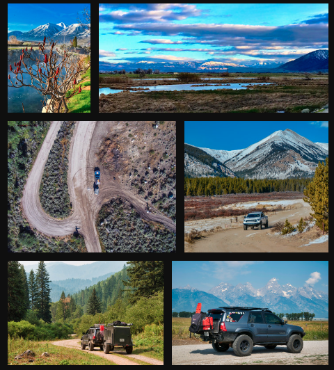
Just before we hit Fairbanks, we headed to Circle via the Steese Highway. Circle is located 160 miles North of Fairbanks on the Yukon river. It was named by gold miners thinking they were on the Arctic Circle, though actually they were 50 miles south of it. During the pre-Klondike gold rush days, Circle was known as the largest log cabin city in the world, “Paris of the North,” with eight dance halls and 28 saloons. The discovery of gold in the Klondike reduced the town in size and importance, then becoming a jumping off point for mining operations along the Yukon river.
The Steese Highway starts off paved, then becomes dirt/gravel. The road plunges into the boreal forest with the pine trees so thick, the trunks seemed like a sold wall. As we drove, we started gaining in elevation and the scenery started to change. The trees gave way to tundra, and the land seemed to be covered in a carpet. We stopped at Eagle Summit, which at 3,600 ft elevation, was the highest point on the highway.
Since it was summer, the land was alive with little flowers. We spent some time reading the information placards that explained the tundra life and the wildlife that live there. We were surprised that grizzly bears inhabit the tundra as well as the forest. Standing on the summit we, were treated with the pure sounds of nature: the wind blowing, the occasional chirp of a bird and the low buzz of insects.
Our solitude was broken with the sound of a of a diesel Super Duty pulling into the summit parking area. Time to move on.
Back on the road, we could see the expanse of the tundra dotted with remains of the winter snow. One could only imagine how brutal the winters are.
Suddenly the radio came alive with Larry’s voice exclaiming “Look! At 10 o’clock! A wolf!” We quickly stopped and brought up our binoculars, scanning the tundra for movement, but we had missed him. Larry explained that he saw some movement, turned his he ad and saw a wolf with an animal in its mouth shaking it...possibly a Caribou calf.
We dropped back down in the forest and drove past homesteads off the road. No powerlines up here, true living off the grid. The idea of living up here in the wilderness is very appealing, even romantic. That is until you start thinking of hauling water, chopping wood, or driving four hours to buy essentials. A tough life not suited for everyone.
As we neared Circle, there were more residences; some along the river had fish wheels on the bank. We finally made it to Circle and the end of the road. The Yukon River is immense, extremely wide and flowing rapidly. In a way, it reminded me of portions of the Amazon River I have seen. Along the bank were some small boats pulled up to the shore and a small one vehicle ferry.
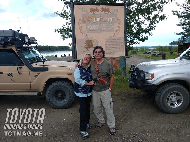
Looking at the river, I could imagine the steam-powered river boats fighting against the current, carrying thousands of anxious gold miners to the Klondike gold fields; none of them knowing the gold rush of 1898, the year before, was already over.

The municipal camping area was a dirt lot and not very appealing. Also not appealing: the drunken guys milling about and very interested in our presence. We took a couple of pictures and headed a block away to the H.C Company store. General stores like this in the countryside are always stocked with the most unusual items. Lisa found some Brer Rabbit molasses, which, unbeknownst to me, she had been looking for.
The owner was an avid photographer of the aurora borealis and the store had many breathtaking pictures of this beautiful phenomenon. Some of the Inuit believe this isa sign of their spirits playing a game with a walrus skull as the “ball”. Anyway, it was too early in the season to be able to view such a gift from Mother Nature.
Time to find a camping site. As we drove south, we stopped at a bar in the small community of Central. We asked about camping and were directed to an area by Bedrock Creek. We were rewarded with a tree covered area next to a creek with rapidly flowing water. No better sound to go to sleep to.
We launched into our familiar routine, and soon Larry had a roaring fire going and the smoke was helping keep the area clear these annoying bloodsuckers. I started on dinner, tonight was chili, in the pressure cooker. The freeze dried sirloin steaks, after rehydrating all afternoon were perfect for this meal. Time for a toast, as always, I splashed a bit of my single malt on the ground for Pachamama (Mother Earth) andwe gave thanks for another successful day.
After a quick resupply in Fairbanks, we headed to Denali National Park. As every other drive in Alaska the scenery was beautiful. We arrived to Denali and were greeted with a chilly rainy dreary day. The town of Denali was a typical tourist trap with cheap t shirt shops to crazy expensive art galleries.
DNP is unique in that one can only drive a small distance into the park. The majority of the park can only be explored by taking a tour bus. This is to minimize the environmental impact on the park by the multitudes of tourists.
We decided on a 4-hour tour. Each bus driver is a trained naturalist so we received an informative briefing about the history of the park, ecosystem and varied wildlife. We also made a couple of stops where there were interpretive Rangers who assumed a persona, such as a Ranger in a cabin from the 1930’s, to explain the hardships in the park endured by the Rangers. DNP is the only park that still uses sled dog teams to conduct winter patrols, which started in the 1920’s.
Like 70% of most DNP visitors we did not see Mt McKinley. After the tour we headed out to the Denali High way and found a nice spot to camp. Despite the rain, we were nice and dry under the Batwing awning.
We awoke to a sunny day and continued on the highway. It seemed with each curve of the road the scenery was more spectacular than the previous view. We were greeted with glacier views and vistas that went on for miles.
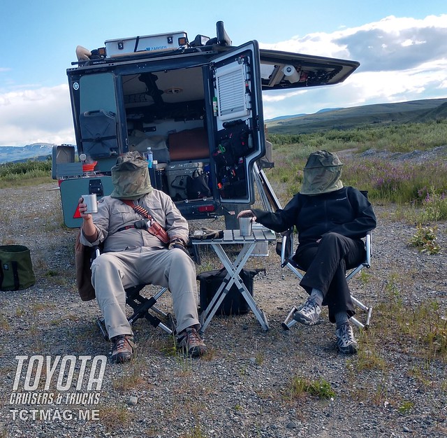
With daylight lasting almost 24 hours, we almost lost track of time and finally set up camp in the sight of the Gulkana Glacier. As usual I did a walk around looking for bear sign and saw some spoor in the soft ground. There seemed to be no escape from the omnipresence of bears in Alaska. We had air horns, bear spray, and as a last resort: guns.
This was the first time we had to use our head nets, though not against mosquitoes but against flies. Tomorrow we would start driving north to start our trip south back home.We broke camp early and headed to Delta Junction, which is the terminus of the AlcanHighway. The name makes one think of a town but there is not much there. A couple of motels, an RV park, IGA, NAPA, restaurants and two gas stations. As fate would have it a friend of Lisa’s lives in Delta Junction, so we were meeting Debbie for breakfast.
Debbie was waiting at the Alaska Steak House for us and we had a gigantic breakfast. We took advantage of the Wi-Fi to catch up on news and of course social media.
Over breakfast, Debbie filled us in on how it was living in a small Alaskan town andhow Alaska attracts people who just want to escape the world and be alone for many different reasons.
After breakfast we were back on the Alcan headed east. Next stop was Tok, which is the first stop in Alaska on the Alcan Highway. We had to meet up with Brian of Wolfhawk Shipping to arrange to send our handguns back to Montana.
Traveling in Canada with handguns is very difficult. We had heard horror stories from other travelers, especially from Texas, being extensively searched by Canadian Customs while being asked “Where is the handgun? I know you have one, you’re from Texas.”
Related Articles
Much easier is to stop at one of the Wolfhawk Shipping affiliated FFL dealers in Montana or Washington (other locations as well). That dealer will ship your pistol, holsters, magazines to Wolfhawk in Tok. You pick up your package and you will be appropriately armed while in Alaska. This works as it is not a FFL transfer. A great system.
A quick top off with fuel and we were headed to Chicken Alaska. As we drove North on the Taylor Highway, we were back in pristine wilderness. The first 60 or so miles are paved, but due to the frost heaves, it can be a roller coaster ride.
We headed to a nice BLM campground, West Fork, for the evening. We had purchased some fresh food at the Three Bears in Tok and were ready to kick back, toast another day on the road and make some spicy sausage skillet—one of my favorite dishes for the Skottle.
The campground was empty, with the exception of some bicyclists and the camp host Hans from Phoenix. Of note was the latrine in this campground; it was spotless and Hans accepted our compliments with a broad smile.
As Lisa and Larry gathered firewood, I prepped dinner and soon the Italian sausage, onions, mushrooms and zucchini were cooking away. With a nice fire in the fire ring and cocktails in hand we consulted the map and planned our next day. Soon dinner was ready and paired with a nice Cabernet Sauvignon we had a five-star meal in the best outdoor restaurant God could offer.
It was day 48 and for some reason we were starting to think that it was time to head home. Home was a good two weeks away.
The road changed to gravel and was smoother. Next up was Chicken Alaska—an old mining town. The original miners wanted to name the town after an indigenous bird that provided food for them: the ptarmigan. Problem was, none of the miners could spell Ptarmigan, so they went with Chicken. The town and surrounding area still have active gold mining operations.

Chicken has a RV park/ gift shop, post office, bar and burger barn. At the Chicken Gold Camp there is the opportunity to rent gold pans, sluices, dredges and to pan for gold in Chicken Creek. Any gold you find you get to keep.

The Pedro Dredge (on the National Register of Historic Places) is also located at the camp. The dredge operated from 1938 to 1967, first in Pedro Creek, north of Fairbanks. There the 500-ton dredge was disassembled, moved to Chicken and reassembled to work in Chicken Creek. The dredge mined over 55,000 ounces of gold the eight years it worked on Chicken Creek. The sheer size and complexity of this machine is a tribute to the ingenuity of man and his desire to obtain riches.
The road is curvy and gravel. At times it follows creeks and we could see people panning for gold as well as one large mining operation with heavy equipment. We guessed it must be worthwhile for all the expense of obtaining that expensive equipment and transporting to the middle of nowhere.
We are now driving on the “Top of the World” highway heading for Dawson City, Yukon. We were lucky to have a clear day to enjoy the never-ending views. We were soon running out of Alaska and would be crossing into Canada.
We pulled over by the ruins of an old roadhouse. Time to unload the 45/70 and 12 Ga. and get them safely into cases so as not to scare the Canadians when we cross the border.
Right before the border crossing the gravel/dirt road becomes paved and we rolled up to the port of entry. Crossing back into Canada was easy. I guessed they could see we did not have any handguns on our prior entrances, so we were quickly on our way.
Shortly we would be in famous Dawson City the destination for the thousands of men and women hopeful to strike it rich in the goldfields. But alas, if only they knew the gold rush was over a year before they actually made to Dawson City.
Dawson City is the home of the sour toe cocktail and that where the story takes a turn, a turn to the north.

[flickr set=72157708837422352]
You can also get Toyota Cruisers & Trucks delivered straight to your iPad/Tablet or Phone via the TCT Magazine app.
To get your copy of the
Winter 2019 Issue:
Follow us on Facebook, Twitter, and Instagram to get up-to-date industry news, events, and of course, amazing adventures, stories, and photos!


